Bildergalerie überspringen


Gratis Lieferung
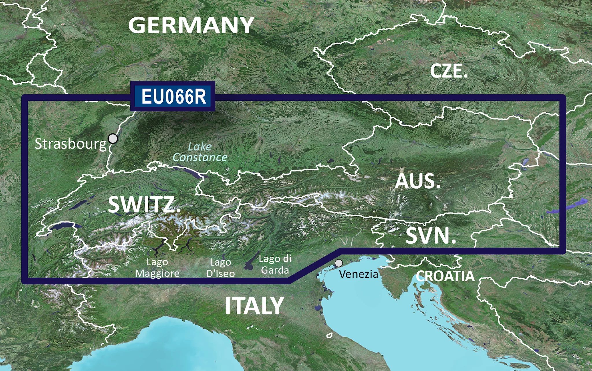
Garmin HXEU066R - Alpine Lakes
microSD™/SD™ card
656728187
Verfügbarkeit:
nicht lagernd
-
 Schon mit Cashpresso zu 0% Zinsen für 12 Monate finanzieren
Mehr erfahren
Produktgalerie überpringen
Könnte dich auch interessieren
Gratis Lieferung
Produktgalerie überpringen
Ähnliche Artikel
Gratis Lieferung
Gratis Lieferung
Produktinformationen
"Garmin HXEU066R - Alpine Lakes"
Alpine Lakes
BlueChart g3 | HXEU066R | microSD™/SD™
Unparalleled Coastal Chart Coverage
- Provides exceptional coverage, clarity and detail with coastal charts that feature integrated Garmin and Navionics® data
- Auto Guidance¹ technology calculates a route using your desired depth and overhead clearance and provides a suggested path to follow
- Includes depth range shading for up to 10 depth ranges, enabling you to view your target depth at a glance
- Up to 1’ contours provide a more accurate depiction of the bottom structure for improved fishing charts and navigation in swamps, canals and marinas
Experience unparalleled coverage and brilliant detail when you’re on the water with charts that feature integrated Navionics® data, Auto Guidance technology¹ and more.
Auto Guidance Technology
Whether you are fishing or cruising, select a spot, and get a route showing you the general path and nearby obstructions at a safe depth¹ .
Depth Range Shading
This feature displays high-resolution depth range shading for up to 10 depth ranges so you can view your designated target depth.
Detailed Contours
BlueChart g3 charts feature 1’ contours that provide a more accurate depiction of bottom structure for improved fishing charts and enhanced detail in swamps, canals and port plans.
Shallow Water Shading
To aid in navigation, Shallow Water Shading allows map shading at a user-defined depth to give a clear picture of shallow waters.
Abdeckung
Covers the lakes and rivers of the Alpine region of Europe. Coverage includes Lakes Constance (Upper, Lower and Seerhein), Zurich, Lucerne, Geneva, Thun, Brienz, Annecy, Bourget, d'Aiguebelette, Neuchatal, Maggiore, Orta, Como, Iseo, Lugano, Garda, Biel and Neusiedl/Ferto. Rivers include the Rhine from it's headwaters to Germersheim, the Danube from it's headwaters to Bratislava, the Necklar from it's headwaters to Offenau and the Main-Danube Canal from Hilpoltein to the Danube. Other rivers include the Isar, the Inn, the Salzach and the Lech in their entireties.
¹Auto Guidance is for planning purposes only and does not replace safe navigation practices. Auto Guidance is not included in preloaded BlueChart g3 for ECHOMAP™ Plus series chartplotters
Es werden ständig technische Verbesserungen vorgenommen, die in den Abbildungen, Videos und Angaben unter Umständen nicht berücksichtigt sind.
Produktinformationen "Bewertungen"
Produktinformationen "Spezifikationen"
Produkt-Nr.:
656728187
Erweiterte Beschreibung:
microSD™/SD™ card
Herstellerartikelnr.:
010-C1208-20
EAN:
0753759255343
Garantie:
12 Monate
Produktinformationen "Produktsicherheit"
Angaben zur Produktsicherheit
Garmin
Seering 7
8141 Unterpremstätten
Kunden aus Österreich erreichen uns unter +43 (0)820 – 220230**
** 14,5 ct/min aus dem österreichischen Festnetz & Mobilfunknetz
Herzlich Willkommen im Garmin-Reklamations-Portal:
https://support.garmin.com/de-DE/exchange/
+43 (0)820 – 220230
** 14,5 ct/min aus dem österreichischen Festnetz & Mobilfunknetz
Herzlich Willkommen im Garmin-Reklamations-Portal:
https://support.garmin.com/de-DE/exchange/
+43 (0)820 – 220230